Wind & Swell
Wind plays a large role in fishing success as light winds push bait to the far shore, and of course game fish follow while strong winds pull surface water along with it as it blows across the ocean surface. The 'hole' left behind is then filled in with an 'upswell' by cold, nutrient rich water from below.
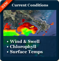
On the Current Conditions Map, click on the Buoys for wind direction, wave height and other weather related information impacting upswells such as atmospheric pressure and air versus water temperature.
Remember that prevailing winds are very important for those venturing offshore. When wind and swell are running in opposite directions, rough and often dangerous conditions can occur.
Chlorophyll
Chlorophyll in the water is generally produced by plankton of which represents nutrient rich waters. So in effect Chlorophyll levels measure the amount of food in the water.
On the Current Conditions Map you will see that high levels of chlorophyll are indicated by yellow/orange while lower levels of chlorophyll indicate cleaner, greenish water and the very low levels will indicate clean, clear blue water.
The border between between high and low Chlorophyll levels is generally considered to be the best fishing location as the fish come from the blue water to feed.
Surface Temp
Most feeding activity is on or near the water's warm surface. On the Current Conditions Map, warmer water is indicated by red/orange and you'll notice that most of the Gulf of Mexico is consistently warm water.
Warm fronts will cause surface water temperatures to increase putting fish into a feeding mode as they instinctively know that usually means a storms is on it's way.
So, keep an eye on the Current Conditions Map on our website to see why, on an average day, fishing Venice, LA presents superior fishing conditions with light winds, plentiful chlorophyll borders and warm waters.
Catch On!
Captain Mike
www.CajunOdysea.com

